Trail Walking Besse-et-Saint-Anastaise - superBesse-Vassiviere_T - Photo
 force
force

User

© OpenStreetMap contributors
Length
Length
12.5 km
Max alt
Max alt
1688 m
Uphill gradient
Uphill gradient
491 m
Km-Effort
Km-Effort  
19.1 km
Min alt
Min alt
1260 m
Downhill gradient
Downhill gradient
493 m
Boucle
Boucle
Yes
Creation date :
2017-06-13 00:00:00.0
Updated on :
2017-06-13 00:00:00.0

(0 Reviews)

Walking
Walking
4h02
Difficulty : Medium

Scan this QR Code to open this trail in the SityTrail application

FREE GPS app for hiking

Logo SityTrail SityTrail

IGN / Geographical institutes

Download SityTrail from the App Store Download SityTrail from Google Play

Logo SityTrail SityTrail World

The world is yours!

Download SityTrail from the App Store Download SityTrail from Google Play Download SityTrail on Huawei AppGallery

About

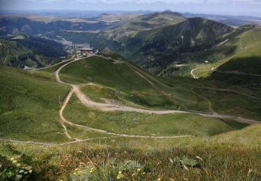
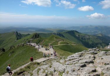
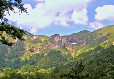
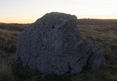
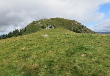
Trail Walking of 12.5 km to be discovered at Auvergne-Rhône-Alpes, Puy-de-Dôme, Besse-et-Saint-Anastaise. This trail is proposed by force.

Description

Boucle entre Super-Besse  et la chapelle de Vassivière. Passage au col du Couhay.

Elevation profile

Positioning

Country:
France
Region :
Auvergne-Rhône-Alpes
Department/Province :
Puy-de-Dôme
Municipality :
Besse-et-Saint-Anastaise
Location:
Unknown
Start:(UTM)
488670 ; 5039868 (31T) N.

Trails nearby

Trail Walking Mont-Dore - Montée au sommet du Puy de Sancy - Photo
Walking
GUIDE
pscheven

Walking

Easy
(1)
Mont-Dore, Auvergne-Rhône-Alpes, Puy-de-Dôme, France
1.4 km | 2.7 km-effort
40min
Yes
Trail Walking Besse-et-Saint-Anastaise - Sancy par Super-Besse - Photo
Walking
tracegps

Walking

Difficult
(1)
Besse-et-Saint-Anastaise, Auvergne-Rhône-Alpes, Puy-de-Dôme, France
10 km | 19.2 km-effort
3h 0min
Yes
Trail Walking Besse-et-Saint-Anastaise - Les 3 lacs et la cascade  - Photo
Walking
zefreefly

Walking

Easy
(1)
Besse-et-Saint-Anastaise, Auvergne-Rhône-Alpes, Puy-de-Dôme, France
19 km | 25 km-effort
7h 24min
Yes
Trail Walking Mont-Dore - Mont_Dore_Puy_Sancy - Photo
Walking
GUIDE
jagarnier

Walking

Difficult
(1)
Mont-Dore, Auvergne-Rhône-Alpes, Puy-de-Dôme, France
6.8 km | 13.9 km-effort
2h 0min
Yes
Trail Walking Chambon-sur-Lac - Chambon_Vallee_Chaudefour_2 - Photo
Walking
GUIDE
jagarnier

Walking

Difficult
(1)
Chambon-sur-Lac, Auvergne-Rhône-Alpes, Puy-de-Dôme, France
15 km | 26 km-effort
4h 30min
Yes
Trail Walking Mont-Dore - le sancy du mont dore par le côté ouest puis revenir par le côté est.  - Photo
Walking
loloetienne

Walking

Difficult
(2)
Mont-Dore, Auvergne-Rhône-Alpes, Puy-de-Dôme, France
8.2 km | 15.4 km-effort
3h 5min
Yes
Trail On foot Besse-et-Saint-Anastaise - La Chapelle de Vassivière - Photo
On foot
PRO

On foot

Easy
Besse-et-Saint-Anastaise, Auvergne-Rhône-Alpes, Puy-de-Dôme, France
11.6 km | 16.7 km-effort
3h 47min
Yes
Trail On foot Besse-et-Saint-Anastaise - Le puy de Montchal et le Lac Pavin - Photo
On foot
PRO

On foot

Easy
Besse-et-Saint-Anastaise, Auvergne-Rhône-Alpes, Puy-de-Dôme, France
6.9 km | 10 km-effort
2h 16min
Yes
Trail On foot Mont-Dore - Le Capucin et le Puy de Cliergue - Photo
On foot
PRO

On foot

Easy
Mont-Dore, Auvergne-Rhône-Alpes, Puy-de-Dôme, France
10.8 km | 18.4 km-effort
4h 10min
Yes


Close
My subscriptions