


Lorraine Tour Parc Ouest raccourci Madine moins dénivelé

alaindurbecq
User

Length
49 km

Max alt
376 m

Uphill gradient
512 m
Km-Effort
56 km

Min alt
179 m

Downhill gradient
584 m
Boucle
No
Creation date :
2017-06-17 00:00:00.0
Updated on :
2017-06-17 00:00:00.0
3h11
Difficulty : Unknown

FREE GPS app for hiking
 SityTrail
IGN / Geographical institutes
SityTrail Plus
The world is yours!
About
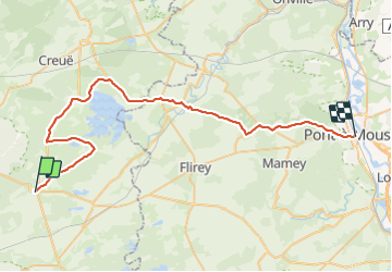
Trail Cycle of 49 km to be discovered at Grand Est, Meuse, Apremont-la-Forêt. This trail is proposed by alaindurbecq.
Positioning
Country:
France
Region :
Grand Est
Department/Province :
Meuse
Municipality :
Apremont-la-Forêt
Location:
Apremont-la-Forêt
Start:(Dec)
Start:(UTM)
693994 ; 5414729 (31U) N.
Comments