


Mafate par Dos d'Ane - Aurere - Cayenne - Dos d'Ane

cderoffignac
User

Length
30 km

Max alt
964 m

Uphill gradient
2856 m
Km-Effort
68 km

Min alt
252 m

Downhill gradient
2855 m
Boucle
Yes
Creation date :
2017-07-01 00:00:00.0
Updated on :
2017-07-01 00:00:00.0
9h00
Difficulty : Difficult

FREE GPS app for hiking
 SityTrail
IGN / Geographical institutes
SityTrail Plus
The world is yours!
About
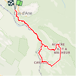
Trail Walking of 30 km to be discovered at Réunion, Unknown, La Possession. This trail is proposed by cderoffignac.
Description
Boucle Mafate partie du GR2 depuis Dos d'Âne puis Deux-Bras, Aurère, Ilet à Malheur, Grand Place les Hauts, Cayenne, Deux-Bras et retour Dos d'Âne
Positioning
Country:
France
Region :
Réunion
Department/Province :
Unknown
Municipality :
La Possession
Location:
Unknown
Start:(Dec)
Start:(UTM)
330980 ; 7679016 (40K) S.
Comments
Rando avec de très beaux panoramas. Partir tôt pour en profiter.