


2017-07-02 Picnic CVA Weiterswiller Reel

holtzv
User GUIDE
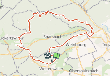

Length
23 km

Max alt
373 m

Uphill gradient
561 m
Km-Effort
30 km

Min alt
193 m

Downhill gradient
550 m
Boucle
Yes
Creation date :
2017-07-02 00:00:00.0
Updated on :
2017-07-02 00:00:00.0
3h59
Difficulty : Easy

FREE GPS app for hiking
 SityTrail
IGN / Geographical institutes
SityTrail Plus
The world is yours!
About
Trail Equestrian of 23 km to be discovered at Grand Est, Bas-Rhin, Weiterswiller. This trail is proposed by holtzv.
Positioning
Country:
France
Region :
Grand Est
Department/Province :
Bas-Rhin
Municipality :
Weiterswiller
Location:
Unknown
Start:(Dec)
Start:(UTM)
383699 ; 5412960 (32U) N.
Comments