


Le Haut Montsalier

lviallet
User
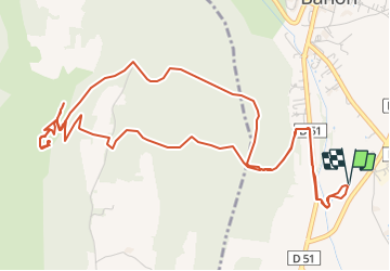

Length
7.7 km

Max alt
906 m

Uphill gradient
254 m
Km-Effort
11 km

Min alt
719 m

Downhill gradient
253 m
Boucle
Yes
Creation date :
2017-07-12 00:00:00.0
Updated on :
2017-07-12 00:00:00.0
2h36
Difficulty : Unknown

FREE GPS app for hiking
 SityTrail
IGN / Geographical institutes
SityTrail Plus
The world is yours!
About
Trail Walking of 7.7 km to be discovered at Provence-Alpes-Côte d'Azur, Alpes-de-Haute-Provence, Banon. This trail is proposed by lviallet.
Description
Faite le 07/07/2017: très sympa...
Positioning
Country:
France
Region :
Provence-Alpes-Côte d'Azur
Department/Province :
Alpes-de-Haute-Provence
Municipality :
Banon
Location:
Unknown
Start:(Dec)
Start:(UTM)
710869 ; 4878291 (31T) N.
Comments