


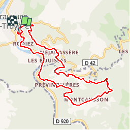
Entraygues-sur-Truyère PR 10

loursblanc
User

Length
10.6 km

Max alt
463 m

Uphill gradient
413 m
Km-Effort
16.1 km

Min alt
226 m

Downhill gradient
414 m
Boucle
Yes
Creation date :
2017-07-10 00:00:00.0
Updated on :
2017-07-10 00:00:00.0
3h36
Difficulty : Medium

FREE GPS app for hiking
 SityTrail
IGN / Geographical institutes
SityTrail Plus
The world is yours!
About
Trail Walking of 10.6 km to be discovered at Occitania, Aveyron, Entraygues-sur-Truyère. This trail is proposed by loursblanc.
Description
Très belle rando ,petit sentier, beaucoup de panorama. L' arrivé se fait sur 2 km de route ,dommage.
Photos


Positioning
Country:
France
Region :
Occitania
Department/Province :
Aveyron
Municipality :
Entraygues-sur-Truyère
Location:
Unknown
Start:(Dec)
Start:(UTM)
465879 ; 4943098 (31T) N.
Comments
Pour éviter la route départementale, il faut remonter à Previnquieres pour rejoindre le tracé aller.