


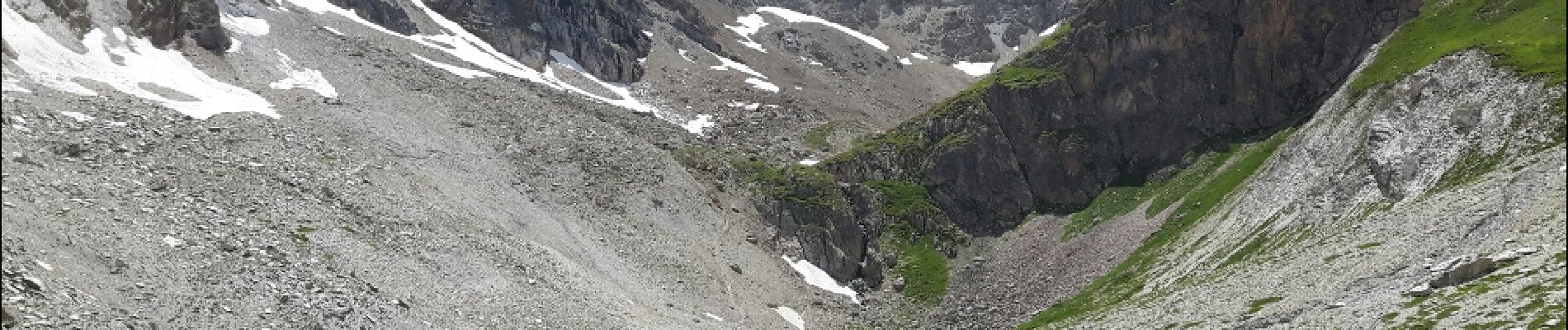
le lac et le col des Béraudes

amiral13
User GUIDE
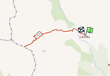

Length
8.8 km

Max alt
2765 m

Uphill gradient
779 m
Km-Effort
19.2 km

Min alt
2003 m

Downhill gradient
779 m
Boucle
Yes
Creation date :
2018-05-08 00:00:00.0
Updated on :
2018-05-08 00:00:00.0
6h24
Difficulty : Medium

FREE GPS app for hiking
 SityTrail
IGN / Geographical institutes
SityTrail Plus
The world is yours!
About
Trail Walking of 8.8 km to be discovered at Provence-Alpes-Côte d'Azur, Hautes-Alpes, Névache. This trail is proposed by amiral13.
Photos


Positioning
Country:
France
Region :
Provence-Alpes-Côte d'Azur
Department/Province :
Hautes-Alpes
Municipality :
Névache
Location:
Unknown
Start:(Dec)
Start:(UTM)
305425 ; 4992309 (32T) N.
Comments