


Col du lac

ARVIEU
User

Length
105 km

Max alt
633 m

Uphill gradient
1875 m
Km-Effort
130 km

Min alt
101 m

Downhill gradient
1872 m
Boucle
No
Creation date :
2017-07-14 00:00:00.0
Updated on :
2024-08-25 20:18:58.019
5h00
Difficulty : Difficult

FREE GPS app for hiking
 SityTrail
IGN / Geographical institutes
SityTrail Plus
The world is yours!
About
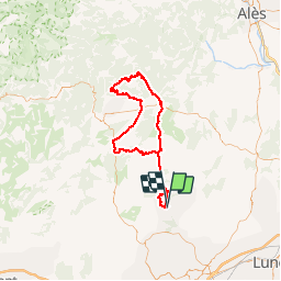
Trail Cycle of 105 km to be discovered at Occitania, Hérault, Saint-Mathieu-de-Tréviers. This trail is proposed by ARVIEU.
Description
au départ de Saint Mathieu de Tréviers col du lac par St Hyppolite du Fort, St Roman de Codières, la Cadière er Cambo, St Bauzille de Putois, Ferrières les Verreries...
Positioning
Country:
France
Region :
Occitania
Department/Province :
Hérault
Municipality :
Saint-Mathieu-de-Tréviers
Location:
Unknown
Start:(Dec)
Start:(UTM)
570479 ; 4847286 (31T) N.
Comments