


Mont Joly

cron
User

Length
17.3 km

Max alt
2499 m

Uphill gradient
1335 m
Km-Effort
35 km

Min alt
1313 m

Downhill gradient
1333 m
Boucle
Yes
Creation date :
2017-07-21 00:00:00.0
Updated on :
2017-07-21 00:00:00.0
7h39
Difficulty : Difficult

FREE GPS app for hiking
 SityTrail
IGN / Geographical institutes
SityTrail Plus
The world is yours!
About
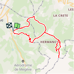
Trail Walking of 17.3 km to be discovered at Auvergne-Rhône-Alpes, Upper Savoy, Megève. This trail is proposed by cron.
Positioning
Country:
France
Region :
Auvergne-Rhône-Alpes
Department/Province :
Upper Savoy
Municipality :
Megève
Location:
Unknown
Start:(Dec)
Start:(UTM)
316601 ; 5079694 (32T) N.
Comments