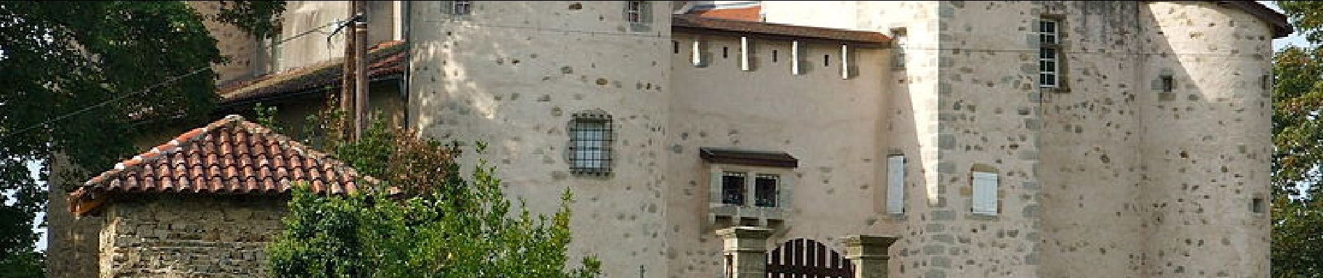
Thiers_Horts

jagarnier
User GUIDE
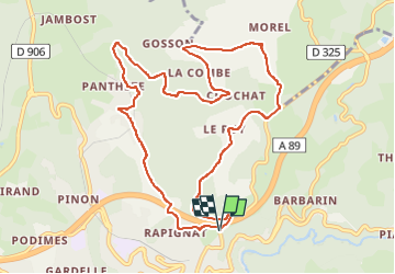

Length
11 km

Max alt
673 m

Uphill gradient
381 m
Km-Effort
16.1 km

Min alt
381 m

Downhill gradient
381 m
Boucle
Yes
Creation date :
2017-07-21 00:00:00.0
Updated on :
2024-03-24 13:33:44.046
3h15
Difficulty : Medium

FREE GPS app for hiking
 SityTrail
IGN / Geographical institutes
SityTrail Plus
The world is yours!
About
Trail Walking of 11 km to be discovered at Auvergne-Rhône-Alpes, Puy-de-Dôme, Thiers. This trail is proposed by jagarnier.
Description
Depuis le château des Horts, vous irez de fermes en hameaux sur les traces des anciennes communautés paysannes.
Photos

Positioning
Country:
France
Region :
Auvergne-Rhône-Alpes
Department/Province :
Puy-de-Dôme
Municipality :
Thiers
Location:
Unknown
Start:(Dec)
Start:(UTM)
542848 ; 5079072 (31T) N.
Comments