


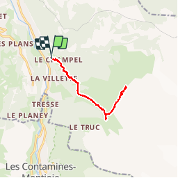
Rando le champel -chalet de miage - col du tricot - le champel

bubufred
User

Length
12.1 km

Max alt
2117 m

Uphill gradient
1088 m
Km-Effort
27 km

Min alt
1163 m

Downhill gradient
1084 m
Boucle
Yes
Creation date :
2017-07-22 00:00:00.0
Updated on :
2017-07-22 00:00:00.0
4h55
Difficulty : Difficult

FREE GPS app for hiking
 SityTrail
IGN / Geographical institutes
SityTrail Plus
The world is yours!
About
Trail Walking of 12.1 km to be discovered at Auvergne-Rhône-Alpes, Upper Savoy, Saint-Gervais-les-Bains. This trail is proposed by bubufred.
Positioning
Country:
France
Region :
Auvergne-Rhône-Alpes
Department/Province :
Upper Savoy
Municipality :
Saint-Gervais-les-Bains
Location:
Unknown
Start:(Dec)
Start:(UTM)
324023 ; 5081025 (32T) N.
Comments