


SAINT-VAAST LA HOUGUE

AndreLACOMBE
User

Length
10.3 km

Max alt
9 m

Uphill gradient
28 m
Km-Effort
10.7 km

Min alt
-2 m

Downhill gradient
28 m
Boucle
No
Creation date :
2017-07-23 00:00:00.0
Updated on :
2017-07-23 00:00:00.0
3h20
Difficulty : Easy

FREE GPS app for hiking
 SityTrail
IGN / Geographical institutes
SityTrail Plus
The world is yours!
About
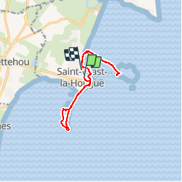
Trail Walking of 10.3 km to be discovered at Normandy, Manche, Saint-Vaast-la-Hougue. This trail is proposed by AndreLACOMBE.
Description
Fort de la Hougue et ile Tatihou
Positioning
Country:
France
Region :
Normandy
Department/Province :
Manche
Municipality :
Saint-Vaast-la-Hougue
Location:
Unknown
Start:(Dec)
Start:(UTM)
625391 ; 5494215 (30U) N.
Comments