


Bugarach col de Linas

jopost
User
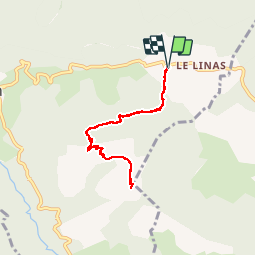

Length
7.3 km

Max alt
1210 m

Uphill gradient
572 m
Km-Effort
15 km

Min alt
670 m

Downhill gradient
575 m
Boucle
Yes
Creation date :
2017-07-23 00:00:00.0
Updated on :
2019-09-02 11:00:23.914
3h11
Difficulty : Difficult

FREE GPS app for hiking
 SityTrail
IGN / Geographical institutes
SityTrail Plus
The world is yours!
About
Trail Walking of 7.3 km to be discovered at Occitania, Aude, Bugarach. This trail is proposed by jopost.
Photos


Positioning
Country:
France
Region :
Occitania
Department/Province :
Aude
Municipality :
Bugarach
Location:
Unknown
Start:(Dec)
Start:(UTM)
449771 ; 4747502 (31T) N.
Comments
belle balade