


22- Le Jura

fitz2014
User

Length
12.2 km

Max alt
170 m

Uphill gradient
217 m
Km-Effort
15.1 km

Min alt
77 m

Downhill gradient
216 m
Boucle
Yes
Creation date :
2017-07-31 00:00:00.0
Updated on :
2017-07-31 00:00:00.0
3h15
Difficulty : Medium

FREE GPS app for hiking
 SityTrail
IGN / Geographical institutes
SityTrail Plus
The world is yours!
About
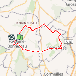
Trail Walking of 12.2 km to be discovered at Hauts-de-France, Oise, Fontaine-Bonneleau. This trail is proposed by fitz2014.
Positioning
Country:
France
Region :
Hauts-de-France
Department/Province :
Oise
Municipality :
Fontaine-Bonneleau
Location:
Unknown
Start:(Dec)
Start:(UTM)
438533 ; 5501356 (31U) N.
Comments
très beau parcours ensoleillé