


TEST

Fdum
User
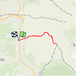

Length
13 km

Max alt
2573 m

Uphill gradient
763 m
Km-Effort
23 km

Min alt
1826 m

Downhill gradient
761 m
Boucle
Yes
Creation date :
2017-08-01 00:00:00.0
Updated on :
2017-08-01 00:00:00.0
4h42
Difficulty : Easy

FREE GPS app for hiking
 SityTrail
IGN / Geographical institutes
SityTrail Plus
The world is yours!
About
Trail Walking of 13 km to be discovered at Réunion, Unknown, Saint-Leu. This trail is proposed by Fdum.
Description
2017
Positioning
Country:
France
Region :
Réunion
Department/Province :
Unknown
Municipality :
Saint-Leu
Location:
Unknown
Start:(Dec)
Start:(UTM)
329814 ; 7661098 (40K) S.
Comments