


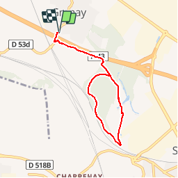

10.8 km | 13.4 km-effort


User


FREE GPS app for hiking
 SityTrail
IGN / Geographical institutes
SityTrail World
The world is yours!
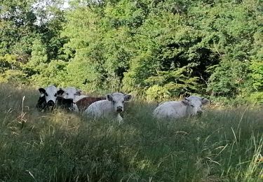
Trail Walking of 6.7 km to be discovered at Auvergne-Rhône-Alpes, Isère, Grenay. This trail is proposed by lydiaodile.
Trajet voiture GRENAY-Chêneraie 1
GPS Pk : 45°39'36.8"N 5°04'36.0"E ou 45.660226, 5.076659
Adresse Pk : - Av du 19 mars 1962 - 38540 GRENAY
• Rejoindre la rte d'Heyrieux, la suivre jusqu'à St Pierre de Chandieu.
• Tourner à gauche Chemin de Satolas (en direction du lotissement Les Avocats), puis 2e à droite (D53A)
• continuer sur cette route jusqu'à la 1e rue à gauche après le pont au-dessus de l'A43.Tourner à droite et se garer vers la ferme
Walking
Mountain bike

Walking
Walking
Walking
Walking
Walking
Walking
Walking