


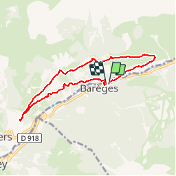
les plateaux de baréges

mistral86
User

Length
7.5 km

Max alt
1419 m

Uphill gradient
262 m
Km-Effort
11 km

Min alt
1217 m

Downhill gradient
267 m
Boucle
Yes
Creation date :
2017-08-07 00:00:00.0
Updated on :
2017-08-07 00:00:00.0
2h02
Difficulty : Medium

FREE GPS app for hiking
 SityTrail
IGN / Geographical institutes
SityTrail Plus
The world is yours!
About
Trail Walking of 7.5 km to be discovered at Occitania, Hautespyrenees, Barèges. This trail is proposed by mistral86.
Description
randonnée de 9km à la découverte des plateaux de baréges.
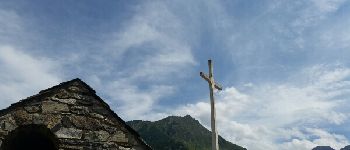
petit vue panoramique de la croix de saint justin.
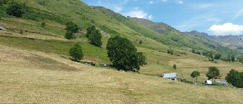
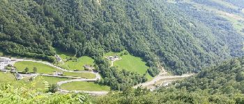
Photos


Positioning
Country:
France
Region :
Occitania
Department/Province :
Hautespyrenees
Municipality :
Barèges
Location:
Unknown
Start:(Dec)
Start:(UTM)
260331 ; 4753516 (31T) N.
Comments