


dents blanches et Midi 6

cron
User
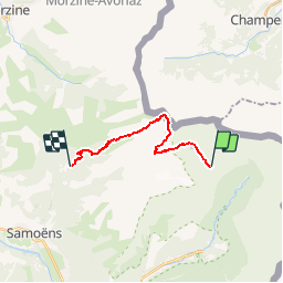

Length
13 km

Max alt
2525 m

Uphill gradient
714 m
Km-Effort
25 km

Min alt
1113 m

Downhill gradient
1492 m
Boucle
No
Creation date :
2017-08-13 00:00:00.0
Updated on :
2017-08-13 00:00:00.0
4h39
Difficulty : Medium

FREE GPS app for hiking
 SityTrail
IGN / Geographical institutes
SityTrail Plus
The world is yours!
About
Trail Walking of 13 km to be discovered at Auvergne-Rhône-Alpes, Upper Savoy, Sixt-Fer-à-Cheval. This trail is proposed by cron.
Positioning
Country:
France
Region :
Auvergne-Rhône-Alpes
Department/Province :
Upper Savoy
Municipality :
Sixt-Fer-à-Cheval
Location:
Unknown
Start:(Dec)
Start:(UTM)
332919 ; 5108803 (32T) N.
Comments