


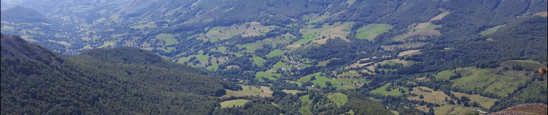
Puy Griou

amiral13
User GUIDE
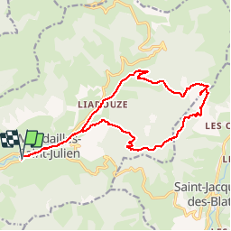

Length
18.7 km

Max alt
1657 m

Uphill gradient
821 m
Km-Effort
30 km

Min alt
895 m

Downhill gradient
820 m
Boucle
Yes
Creation date :
2018-04-16 20:51:38.499
Updated on :
2018-04-16 20:51:38.499
9h14
Difficulty : Medium

FREE GPS app for hiking
 SityTrail
IGN / Geographical institutes
SityTrail Plus
The world is yours!
About
Trail Walking of 18.7 km to be discovered at Auvergne-Rhône-Alpes, Cantal, Mandailles-Saint-Julien. This trail is proposed by amiral13.
Photos


Positioning
Country:
France
Region :
Auvergne-Rhône-Alpes
Department/Province :
Cantal
Municipality :
Mandailles-Saint-Julien
Location:
Unknown
Start:(Dec)
Start:(UTM)
471527 ; 4989996 (31T) N.
Comments