Trail Walking Saint-Igny-de-Vers - Ajoux (69) - Photo
© OpenStreetMap contributors
Length
Length
15.8 km
Max alt
Max alt
840 m
Uphill gradient
Uphill gradient
516 m
Km-Effort
Km-Effort  
23 km
Min alt
Min alt
502 m
Downhill gradient
Downhill gradient
523 m
Boucle
Boucle
Yes
Creation date :
2017-08-21 00:00:00.0
Updated on :
2017-08-21 00:00:00.0

(0 Reviews)

Walking
Walking
4h43
Difficulty : Easy

Scan this QR Code to open this trail in the SityTrail application

FREE GPS app for hiking

Logo SityTrail SityTrail

IGN / Geographical institutes

Download SityTrail from the App Store Download SityTrail from Google Play

Logo SityTrail SityTrail World

The world is yours!

Download SityTrail from the App Store Download SityTrail from Google Play Download SityTrail on Huawei AppGallery

About

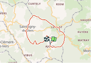
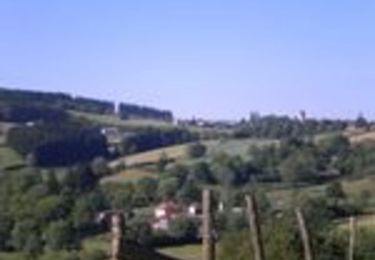
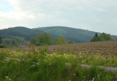
Trail Walking of 15.8 km to be discovered at Auvergne-Rhône-Alpes, Rhône, Saint-Igny-de-Vers. This trail is proposed by Thomasdanielle.

Description

15,8 km D. 500 m
Départ du Hameau Ajoux (sur la D52)
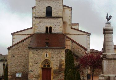
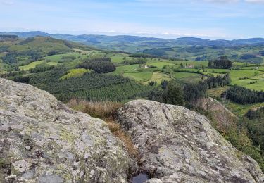
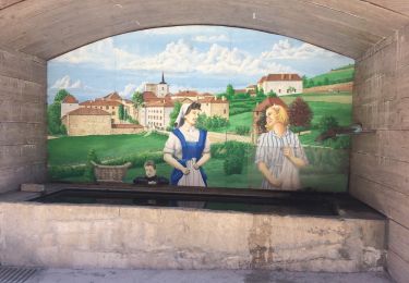
Elevation profile

Photos

Positioning

Country:
France
Region :
Auvergne-Rhône-Alpes
Department/Province :
Rhône
Municipality :
Saint-Igny-de-Vers
Location:
Unknown
Start:(UTM)
613153 ; 5120157 (31T) N.

Trails nearby

Trail On foot Propières - Circuit de Propières n°3 - 15 km - Noir - Photo
On foot
PRO

On foot

Medium
Propières, Auvergne-Rhône-Alpes, Rhône, France
14.3 km | 21 km-effort
4h 46min
Yes
Trail On foot Saint-Clément-de-Vers - Circuit Bleu - Photo
On foot
PRO

On foot

Medium
Saint-Clément-de-Vers, Auvergne-Rhône-Alpes, Rhône, France
16.1 km | 23 km-effort
5h 17min
Yes
Trail On foot Saint-Igny-de-Vers - Circuit des Charmes - Photo
On foot
PRO

On foot

Medium
Saint-Igny-de-Vers, Auvergne-Rhône-Alpes, Rhône, France
14.8 km | 21 km-effort
4h 47min
Yes
Trail On foot Propières - Circuit du Mont Saint-Rigaud 12 km - Photo
On foot
PRO

On foot

Easy
Propières, Auvergne-Rhône-Alpes, Rhône, France
11.8 km | 18.3 km-effort
4h 9min
Yes
Trail Walking Propières - Séjour RCY journée 4 Les crêtes du Haut Beaujolais  - Photo
Walking
chessyca

Walking

Very difficult
Propières, Auvergne-Rhône-Alpes, Rhône, France
28 km | 39 km-effort
6h 48min
No
Trail Walking Saint-Igny-de-Vers - Ajoux (69) - Photo
Walking
Thomasdanielle

Walking

Very easy
Saint-Igny-de-Vers, Auvergne-Rhône-Alpes, Rhône, France
16.6 km | 23 km-effort
4h 55min
Yes
Trail Mountain bike Saint-Igny-de-Vers - Circuit FFC M13 Saint Igny de Vers - Photo
Mountain bike
thio

Mountain bike

Medium
(1)
Saint-Igny-de-Vers, Auvergne-Rhône-Alpes, Rhône, France
91 km | 142 km-effort
3h 25min
Yes
Trail Walking Propières - Circuit de Propières - Photo
Walking
tracegps

Walking

Difficult
Propières, Auvergne-Rhône-Alpes, Rhône, France
14.3 km | 21 km-effort
5h 0min
Yes
Trail Walking Deux-Grosnes - Circuit n°2 du Mont Saint-Rigaud - Monsols - Photo
Walking
tracegps

Walking

Difficult
(2)
Deux-Grosnes, Auvergne-Rhône-Alpes, Rhône, France
11.5 km | 17.9 km-effort
3h 0min
Yes


Close
My subscriptions