


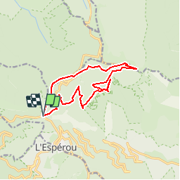
col Serreyrede - Prat Peyrot - Mont Aigoual - Point sublime

vertygo
User

Length
13.8 km

Max alt
1557 m

Uphill gradient
404 m
Km-Effort
19.2 km

Min alt
1286 m

Downhill gradient
410 m
Boucle
Yes
Creation date :
2017-08-21 00:00:00.0
Updated on :
2017-08-21 00:00:00.0
4h00
Difficulty : Unknown

FREE GPS app for hiking
 SityTrail
IGN / Geographical institutes
SityTrail Plus
The world is yours!
About
Trail Other activity of 13.8 km to be discovered at Occitania, Gard, Val-d'Aigoual. This trail is proposed by vertygo.
Description
voir des photos et d'autres parcours sur [url]http://www.vertygo.org[/url]
[img][/img]
[url]https://goo.gl/photos/1qnevCsEnZk3C6ze8[/url]
Positioning
Country:
France
Region :
Occitania
Department/Province :
Gard
Municipality :
Val-d'Aigoual
Location:
Valleraugue
Start:(Dec)
Start:(UTM)
543322 ; 4883482 (31T) N.
Comments