


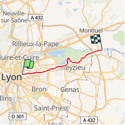
Part-Dieu Pont de Jons

chuck
User

Length
21 km

Max alt
210 m

Uphill gradient
233 m
Km-Effort
24 km

Min alt
168 m

Downhill gradient
213 m
Boucle
No
Creation date :
2018-10-10 11:44:02.673
Updated on :
2018-10-10 11:44:02.679
1h26
Difficulty : Easy

FREE GPS app for hiking
 SityTrail
IGN / Geographical institutes
SityTrail Plus
The world is yours!
About
Trail Cycle of 21 km to be discovered at Auvergne-Rhône-Alpes, Métropole de Lyon, Lyon. This trail is proposed by chuck.
Description
Ballade vélo
Positioning
Country:
France
Region :
Auvergne-Rhône-Alpes
Department/Province :
Métropole de Lyon
Municipality :
Lyon
Location:
Lyon 3e Arrondissement
Start:(Dec)
Start:(UTM)
644806 ; 5069342 (31T) N.
Comments