


Descente de l'Aar

chbolzli
User

Length
17.9 km

Max alt
530 m

Uphill gradient
265 m
Km-Effort
22 km

Min alt
478 m

Downhill gradient
288 m
Boucle
No
Creation date :
2018-04-16 21:44:11.089
Updated on :
2018-04-16 21:44:11.089
3h09
Difficulty : Easy

FREE GPS app for hiking
 SityTrail
IGN / Geographical institutes
SityTrail Plus
The world is yours!
About
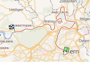
Trail Other activity of 17.9 km to be discovered at Bern, Bern-Mittelland administrative district, Bern. This trail is proposed by chbolzli.
Description
en paddle
Positioning
Country:
Switzerland
Region :
Bern
Department/Province :
Bern-Mittelland administrative district
Municipality :
Bern
Location:
Stadtteil IV
Start:(Dec)
Start:(UTM)
382101 ; 5200197 (32T) N.
Comments