


Refuge de la Cougourde - Lac Trecolpas

jlrayon
User
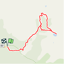

Length
10 km

Max alt
2168 m

Uphill gradient
654 m
Km-Effort
18.7 km

Min alt
1601 m

Downhill gradient
652 m
Boucle
Yes
Creation date :
2017-10-12 00:00:00.0
Updated on :
2017-10-12 00:00:00.0
3h27
Difficulty : Difficult

FREE GPS app for hiking
 SityTrail
IGN / Geographical institutes
SityTrail Plus
The world is yours!
About
Trail Walking of 10 km to be discovered at Provence-Alpes-Côte d'Azur, Maritime Alps, Saint-Martin-Vésubie. This trail is proposed by jlrayon.
Description
Projet
Positioning
Country:
France
Region :
Provence-Alpes-Côte d'Azur
Department/Province :
Maritime Alps
Municipality :
Saint-Martin-Vésubie
Location:
Unknown
Start:(Dec)
Start:(UTM)
364563 ; 4885477 (32T) N.
Comments