Trail Walking Saint-Christophe-du-Ligneron - St-Christophe-du-Ligneron - Photo
 magnum07
magnum07

User

© OpenStreetMap contributors
Length
Length
10.4 km
Max alt
Max alt
66 m
Uphill gradient
Uphill gradient
48 m
Km-Effort
Km-Effort  
11.1 km
Min alt
Min alt
52 m
Downhill gradient
Downhill gradient
47 m
Boucle
Boucle
Yes
Creation date :
2017-09-03 00:00:00.0
Updated on :
2020-09-30 16:12:45.919

(0 Reviews)

Walking
Walking
2h27
Difficulty : Unknown

Scan this QR Code to open this trail in the SityTrail application

FREE GPS app for hiking

Logo SityTrail SityTrail

IGN / Geographical institutes

Download SityTrail from the App Store Download SityTrail from Google Play

Logo SityTrail SityTrail World

The world is yours!

Download SityTrail from the App Store Download SityTrail from Google Play Download SityTrail on Huawei AppGallery

About

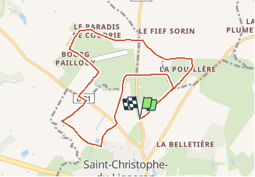
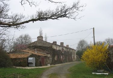
Trail Walking of 10.4 km to be discovered at Pays de la Loire, Vendée, Saint-Christophe-du-Ligneron. This trail is proposed by magnum07.

Elevation profile

Positioning

Country:
France
Region :
Pays de la Loire
Department/Province :
Vendée
Municipality :
Saint-Christophe-du-Ligneron
Location:
Unknown
Start:(UTM)
594321 ; 5187438 (30T) N.

Trails nearby

Trail Mountain bike Froidfond - FROIDFOND - Photo
Mountain bike
alainbruno85ab@gmail.com

Mountain bike

Very easy
(1)
Froidfond, Pays de la Loire, Vendée, France
24 km | 25 km-effort
2h 0min
Yes
Trail Cycle Saint-Christophe-du-Ligneron - La traversée des hameaux - Photo
Cycle
jyv

Cycle

Easy
Saint-Christophe-du-Ligneron, Pays de la Loire, Vendée, France
23 km | 25 km-effort
Unknown
Yes


Close
My subscriptions