


st cloud st nom

olivieraron
User
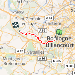

Length
17.8 km

Max alt
181 m

Uphill gradient
385 m
Km-Effort
23 km

Min alt
67 m

Downhill gradient
337 m
Boucle
No
Creation date :
2019-01-14 09:42:51.985
Updated on :
2019-01-14 09:42:52.059
8h40
Difficulty : Unknown

FREE GPS app for hiking
 SityTrail
IGN / Geographical institutes
SityTrail Plus
The world is yours!
About
Trail Other activity of 17.8 km to be discovered at Ile-de-France, Hauts-de-Seine, Saint-Cloud. This trail is proposed by olivieraron.
Positioning
Country:
France
Region :
Ile-de-France
Department/Province :
Hauts-de-Seine
Municipality :
Saint-Cloud
Location:
Unknown
Start:(Dec)
Start:(UTM)
442576 ; 5410588 (31U) N.
Comments