


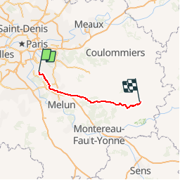
M1 - Yerres Provins

gdruet
User

Length
77 km

Max alt
148 m

Uphill gradient
600 m
Km-Effort
84 km

Min alt
37 m

Downhill gradient
514 m
Boucle
No
Creation date :
2018-04-16 22:19:20.977
Updated on :
2018-04-16 22:19:20.977
4h52
Difficulty : Unknown

FREE GPS app for hiking
 SityTrail
IGN / Geographical institutes
SityTrail Plus
The world is yours!
About
Trail Cycle of 77 km to be discovered at Ile-de-France, Essonne, Yerres. This trail is proposed by gdruet.
Positioning
Country:
France
Region :
Ile-de-France
Department/Province :
Essonne
Municipality :
Yerres
Location:
Unknown
Start:(Dec)
Start:(UTM)
462411 ; 5395769 (31U) N.
Comments