


M2 Provins Chalon

gdruet
User
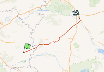

Length
103 km

Max alt
219 m

Uphill gradient
698 m
Km-Effort
113 km

Min alt
79 m

Downhill gradient
737 m
Boucle
No
Creation date :
2017-09-16 00:00:00.0
Updated on :
2017-09-16 00:00:00.0
6h32
Difficulty : Unknown

FREE GPS app for hiking
 SityTrail
IGN / Geographical institutes
SityTrail Plus
The world is yours!
About
Trail Cycle of 103 km to be discovered at Ile-de-France, Seine-et-Marne, Provins. This trail is proposed by gdruet.
Positioning
Country:
France
Region :
Ile-de-France
Department/Province :
Seine-et-Marne
Municipality :
Provins
Location:
Unknown
Start:(Dec)
Start:(UTM)
520770 ; 5378299 (31U) N.
Comments