


St André les Alpes Courchons

pidjam
User

Length
13.3 km

Max alt
1355 m

Uphill gradient
581 m
Km-Effort
21 km

Min alt
881 m

Downhill gradient
580 m
Boucle
Yes
Creation date :
2017-10-05 00:00:00.0
Updated on :
2017-10-05 00:00:00.0
4h24
Difficulty : Medium

FREE GPS app for hiking
 SityTrail
IGN / Geographical institutes
SityTrail Plus
The world is yours!
About
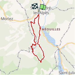
Trail Walking of 13.3 km to be discovered at Provence-Alpes-Côte d'Azur, Alpes-de-Haute-Provence, Saint-André-les-Alpes. This trail is proposed by pidjam.
Description
randonnée à partir du village sur le côté ouest du lac (ruines de Courchons)
Positioning
Country:
France
Region :
Provence-Alpes-Côte d'Azur
Department/Province :
Alpes-de-Haute-Provence
Municipality :
Saint-André-les-Alpes
Location:
Unknown
Start:(Dec)
Start:(UTM)
299977 ; 4871140 (32T) N.
Comments