


du refuge estrop à la foux

bernir
User
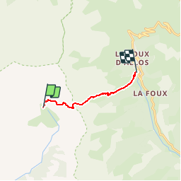

Length
5.4 km

Max alt
2402 m

Uphill gradient
379 m
Km-Effort
11.3 km

Min alt
1766 m

Downhill gradient
625 m
Boucle
No
Creation date :
2017-09-15 00:00:00.0
Updated on :
2017-09-15 00:00:00.0
3h54
Difficulty : Medium

FREE GPS app for hiking
 SityTrail
IGN / Geographical institutes
SityTrail Plus
The world is yours!
About
Trail Walking of 5.4 km to be discovered at Provence-Alpes-Côte d'Azur, Alpes-de-Haute-Provence, Prads-Haute-Bléone. This trail is proposed by bernir.
Positioning
Country:
France
Region :
Provence-Alpes-Côte d'Azur
Department/Province :
Alpes-de-Haute-Provence
Municipality :
Prads-Haute-Bléone
Location:
Prads
Start:(Dec)
Start:(UTM)
302539 ; 4905148 (32T) N.
Comments