


refuge de la selle

Massiac15
User

Length
16.1 km

Max alt
2669 m

Uphill gradient
1046 m
Km-Effort
30 km

Min alt
1640 m

Downhill gradient
1047 m
Boucle
Yes
Creation date :
2018-04-16 22:59:22.126
Updated on :
2018-04-16 22:59:22.126
7h33
Difficulty : Very easy

FREE GPS app for hiking
 SityTrail
IGN / Geographical institutes
SityTrail Plus
The world is yours!
About
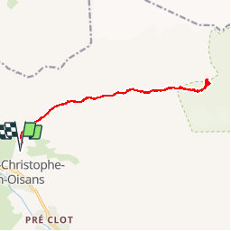
Trail Other activity of 16.1 km to be discovered at Auvergne-Rhône-Alpes, Isère, Saint-Christophe-en-Oisans. This trail is proposed by Massiac15.
Positioning
Country:
France
Region :
Auvergne-Rhône-Alpes
Department/Province :
Isère
Municipality :
Saint-Christophe-en-Oisans
Location:
Unknown
Start:(Dec)
Start:(UTM)
277447 ; 4982763 (32T) N.
Comments