


Charmey René

rene.esseiva
User
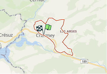

Length
6.4 km

Max alt
981 m

Uphill gradient
211 m
Km-Effort
9.2 km

Min alt
851 m

Downhill gradient
210 m
Boucle
Yes
Creation date :
2017-09-17 00:00:00.0
Updated on :
2017-09-17 00:00:00.0
1h56
Difficulty : Easy

FREE GPS app for hiking
 SityTrail
IGN / Geographical institutes
SityTrail Plus
The world is yours!
About
Trail Walking of 6.4 km to be discovered at Fribourg, Gruyère District, Val-de-Charmey. This trail is proposed by rene.esseiva.
Description
Bicubic-La Sionge-A12-H189-Broc-Charmey Parking Bain de la Gruyère au fond 35 min. Fr. 5.00
Verrée Hôtel Cailler
Positioning
Country:
Switzerland
Region :
Fribourg
Department/Province :
Gruyère District
Municipality :
Val-de-Charmey
Location:
Unknown
Start:(Dec)
Start:(UTM)
359364 ; 5164621 (32T) N.
Comments