


Running à viry

choubaka77
User
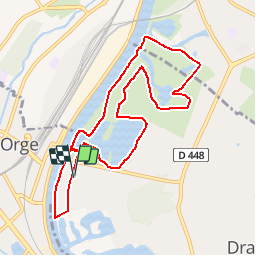

Length
9.3 km

Max alt
46 m

Uphill gradient
61 m
Km-Effort
10.1 km

Min alt
28 m

Downhill gradient
60 m
Boucle
Yes
Creation date :
2018-04-16 23:07:11.916
Updated on :
2018-04-16 23:07:11.916
50m
Difficulty : Very easy

FREE GPS app for hiking
 SityTrail
IGN / Geographical institutes
SityTrail Plus
The world is yours!
About
Trail Running of 9.3 km to be discovered at Ile-de-France, Essonne, Draveil. This trail is proposed by choubaka77.
Positioning
Country:
France
Region :
Ile-de-France
Department/Province :
Essonne
Municipality :
Draveil
Location:
Unknown
Start:(Dec)
Start:(UTM)
455121 ; 5392804 (31U) N.
Comments