


bayasse

barney06
User
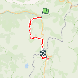

Length
19.3 km

Max alt
2509 m

Uphill gradient
947 m
Km-Effort
32 km

Min alt
1780 m

Downhill gradient
888 m
Boucle
No
Creation date :
2018-04-16 23:15:59.178
Updated on :
2018-04-16 23:15:59.178
9h03
Difficulty : Medium

FREE GPS app for hiking
 SityTrail
IGN / Geographical institutes
SityTrail Plus
The world is yours!
About
Trail Walking of 19.3 km to be discovered at Provence-Alpes-Côte d'Azur, Alpes-de-Haute-Provence, Uvernet-Fours. This trail is proposed by barney06.
Description
rando
Positioning
Country:
France
Region :
Provence-Alpes-Côte d'Azur
Department/Province :
Alpes-de-Haute-Provence
Municipality :
Uvernet-Fours
Location:
Unknown
Start:(Dec)
Start:(UTM)
319909 ; 4908941 (32T) N.
Comments