


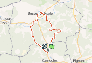
Carnoule-Lac de Besse

soca
User

Length
14.9 km

Max alt
317 m

Uphill gradient
253 m
Km-Effort
18.3 km

Min alt
223 m

Downhill gradient
252 m
Boucle
Yes
Creation date :
2018-04-16 23:16:12.808
Updated on :
2018-04-16 23:16:12.808
3h55
Difficulty : Unknown

FREE GPS app for hiking
 SityTrail
IGN / Geographical institutes
SityTrail Plus
The world is yours!
About
Trail Walking of 14.9 km to be discovered at Provence-Alpes-Côte d'Azur, Var, Carnoules. This trail is proposed by soca.
Positioning
Country:
France
Region :
Provence-Alpes-Côte d'Azur
Department/Province :
Var
Municipality :
Carnoules
Location:
Unknown
Start:(Dec)
Start:(UTM)
271924 ; 4799159 (32T) N.
Comments
bandol