


allos

barney06
User
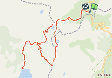

Length
16.5 km

Max alt
2675 m

Uphill gradient
800 m
Km-Effort
27 km

Min alt
2233 m

Downhill gradient
802 m
Boucle
Yes
Creation date :
2017-09-24 00:00:00.0
Updated on :
2017-09-24 00:00:00.0
7h46
Difficulty : Medium

FREE GPS app for hiking
 SityTrail
IGN / Geographical institutes
SityTrail Plus
The world is yours!
About
Trail Walking of 16.5 km to be discovered at Provence-Alpes-Côte d'Azur, Alpes-de-Haute-Provence, Uvernet-Fours. This trail is proposed by barney06.
Description
rando
Positioning
Country:
France
Region :
Provence-Alpes-Côte d'Azur
Department/Province :
Alpes-de-Haute-Provence
Municipality :
Uvernet-Fours
Location:
Unknown
Start:(Dec)
Start:(UTM)
319914 ; 4903172 (32T) N.
Comments