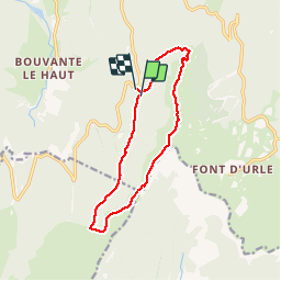
Trail Walking Bouvante - 01 - Photo
 Noiraude
Noiraude

User

© OpenStreetMap contributors
Length
Length
12.5 km
Max alt
Max alt
1697 m
Uphill gradient
Uphill gradient
523 m
Km-Effort
Km-Effort  
19.5 km
Min alt
Min alt
1299 m
Downhill gradient
Downhill gradient
538 m
Boucle
Boucle
Yes
Creation date :
2018-04-16 23:30:49.088
Updated on :
2018-04-16 23:30:49.088

(1 Reviews)

Walking
Walking
5h07
Difficulty : Medium

Scan this QR Code to open this trail in the SityTrail application

FREE GPS app for hiking

Logo SityTrail SityTrail

IGN / Geographical institutes

Download SityTrail from the App Store Download SityTrail from Google Play

Logo SityTrail SityTrail Plus

The world is yours!

Download SityTrail from the App Store Download SityTrail from Google Play Download SityTrail on Huawei AppGallery

About

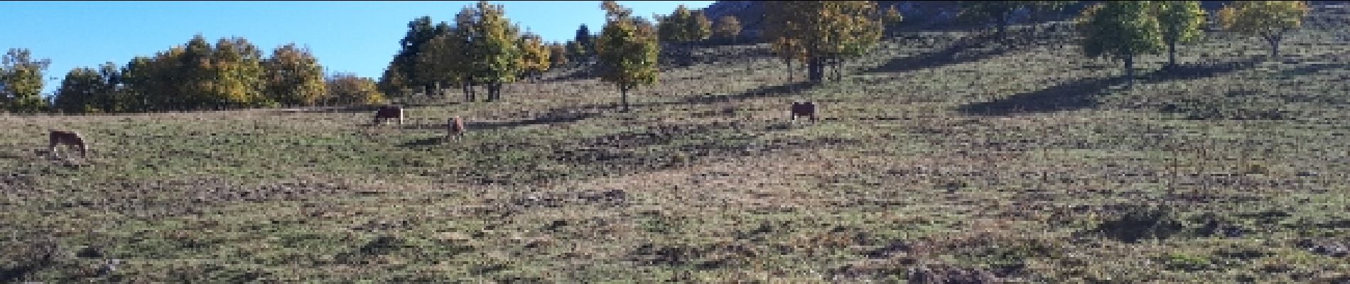
Trail Walking of 12.5 km to be discovered at Auvergne-Rhône-Alpes, Drôme, Bouvante. This trail is proposed by Noiraude.

Elevation profile

Photos

Points of interest

Point of interest Bouvante - Point 8 - Photo
Noiraude
BOUVANTE 
Point of interest Bouvante - Point 9 - Photo
Noiraude
BOUVANTE 

Positioning

Country:
France
Region :
Auvergne-Rhône-Alpes
Department/Province :
Drôme
Municipality :
Bouvante
Location:
Unknown
Start:(UTM)
680985 ; 4976091 (31T) N.

Comments

Please log in to post a review or rate the element


Close
My subscriptions