


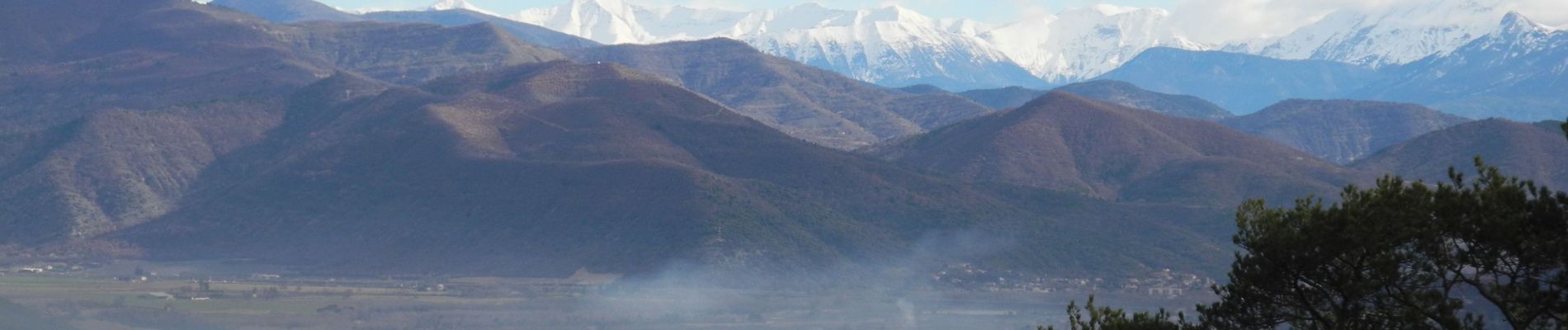
PF-Lurs - Ganagobie

MicDul
User GUIDE
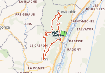

Length
15.6 km

Max alt
710 m

Uphill gradient
553 m
Km-Effort
23 km

Min alt
385 m

Downhill gradient
557 m
Boucle
Yes
Creation date :
2018-04-16 23:33:34.851
Updated on :
2020-04-02 16:37:09.607
4h51
Difficulty : Difficult

FREE GPS app for hiking
 SityTrail
IGN / Geographical institutes
SityTrail Plus
The world is yours!
About
Trail Walking of 15.6 km to be discovered at Provence-Alpes-Côte d'Azur, Alpes-de-Haute-Provence, Lurs. This trail is proposed by MicDul.
Photos


Positioning
Country:
France
Region :
Provence-Alpes-Côte d'Azur
Department/Province :
Alpes-de-Haute-Provence
Municipality :
Lurs
Location:
Unknown
Start:(Dec)
Start:(UTM)
733227 ; 4874295 (31T) N.
Comments