


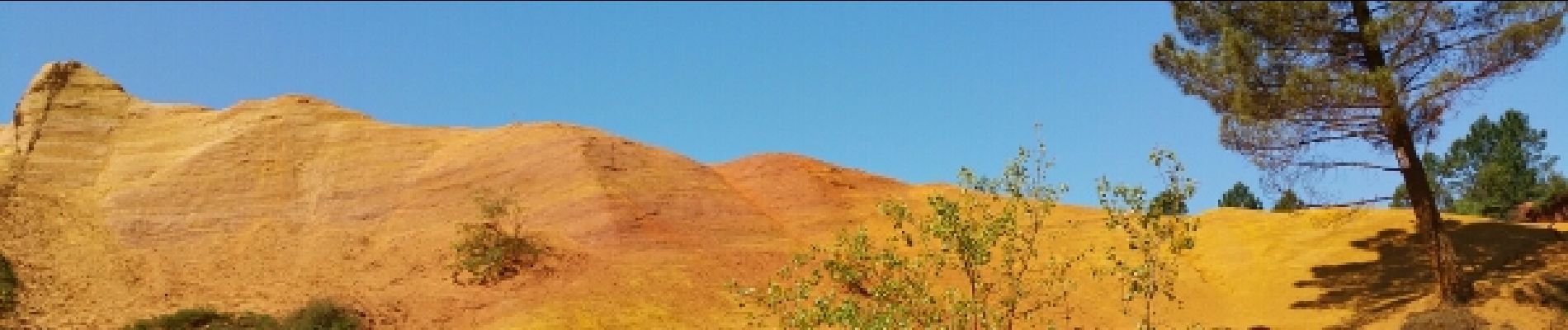
Luberon - Colorado provençal près de Rustrel

uru2010
User
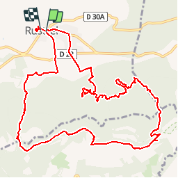

Length
14.6 km

Max alt
574 m

Uphill gradient
363 m
Km-Effort
19.5 km

Min alt
329 m

Downhill gradient
362 m
Boucle
Yes
Creation date :
2018-04-16 23:50:42.903
Updated on :
2018-04-16 23:50:42.903
4h21
Difficulty : Medium

FREE GPS app for hiking
 SityTrail
IGN / Geographical institutes
SityTrail Plus
The world is yours!
About
Trail Walking of 14.6 km to be discovered at Provence-Alpes-Côte d'Azur, Vaucluse, Rustrel. This trail is proposed by uru2010.
Description
A/R depuis Rustrel. Visite et tour du Colorado provençal
Photos


Positioning
Country:
France
Region :
Provence-Alpes-Côte d'Azur
Department/Province :
Vaucluse
Municipality :
Rustrel
Location:
Unknown
Start:(Dec)
Start:(UTM)
699537 ; 4866447 (31T) N.
Comments