


volcan des chirouses

ajd26
User

Length
12.1 km

Max alt
729 m

Uphill gradient
582 m
Km-Effort
19.8 km

Min alt
372 m

Downhill gradient
581 m
Boucle
Yes
Creation date :
2019-05-19 18:03:41.85
Updated on :
2019-05-19 18:03:42.651
3h36
Difficulty : Medium

FREE GPS app for hiking
 SityTrail
IGN / Geographical institutes
SityTrail Plus
The world is yours!
About
Trail Walking of 12.1 km to be discovered at Auvergne-Rhône-Alpes, Ardèche, Pranles. This trail is proposed by ajd26.
Description
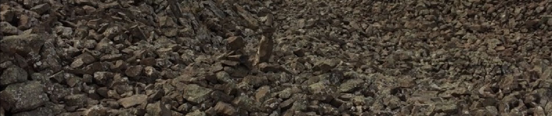
Au départ du Clap à 1km de Pranles 07 Un long pierrier à traverser (au pied du volcan) et ensuite belle balade dans les Châtaigneraies
Photos


Positioning
Country:
France
Region :
Auvergne-Rhône-Alpes
Department/Province :
Ardèche
Municipality :
Pranles
Location:
Unknown
Start:(Dec)
Start:(UTM)
623738 ; 4959176 (31T) N.
Comments