


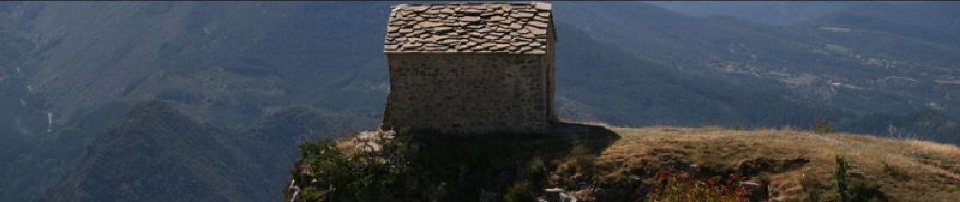
Chapelle Saint-Michel-De-Cousson

lviallet
User
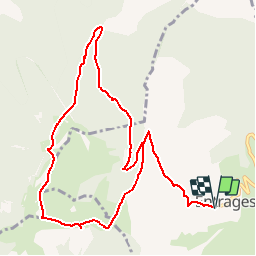

Length
11.9 km

Max alt
1492 m

Uphill gradient
744 m
Km-Effort
22 km

Min alt
961 m

Downhill gradient
744 m
Boucle
Yes
Creation date :
2017-10-22 08:28:56.452
Updated on :
2018-06-18 02:37:54.444
4h14
Difficulty : Unknown

FREE GPS app for hiking
 SityTrail
IGN / Geographical institutes
SityTrail Plus
The world is yours!
About
Trail Walking of 11.9 km to be discovered at Provence-Alpes-Côte d'Azur, Alpes-de-Haute-Provence, Entrages. This trail is proposed by lviallet.
Description
Notre-Dame-De-Cousson est l'une des dix chapelles formant une couronne autour de Digne-Les-Bains
Photos

Positioning
Country:
France
Region :
Provence-Alpes-Côte d'Azur
Department/Province :
Alpes-de-Haute-Provence
Municipality :
Entrages
Location:
Unknown
Start:(Dec)
Start:(UTM)
280898 ; 4880569 (32T) N.
Comments