


serre de montdenier

bernir
User
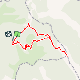

Length
9 km

Max alt
1733 m

Uphill gradient
632 m
Km-Effort
17.4 km

Min alt
1159 m

Downhill gradient
629 m
Boucle
Yes
Creation date :
2018-04-16 23:59:48.92
Updated on :
2018-04-16 23:59:48.92
6h21
Difficulty : Medium

FREE GPS app for hiking
 SityTrail
IGN / Geographical institutes
SityTrail Plus
The world is yours!
About
Trail Walking of 9 km to be discovered at Provence-Alpes-Côte d'Azur, Alpes-de-Haute-Provence, Saint-Jurs. This trail is proposed by bernir.
Positioning
Country:
France
Region :
Provence-Alpes-Côte d'Azur
Department/Province :
Alpes-de-Haute-Provence
Municipality :
Saint-Jurs
Location:
Unknown
Start:(Dec)
Start:(UTM)
277155 ; 4864946 (32T) N.
Comments