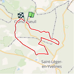
Trail Walking Gambaiseuil - Gambaiseul Boucle - Photo
© OpenStreetMap contributors
Length
Length
13.6 km
Max alt
Max alt
190 m
Uphill gradient
Uphill gradient
202 m
Km-Effort
Km-Effort  
16.3 km
Min alt
Min alt
130 m
Downhill gradient
Downhill gradient
200 m
Boucle
Boucle
No
Creation date :
2018-04-17 10:08:23.174
Updated on :
2018-04-17 10:08:23.174

(1 Reviews)

Walking
Walking
3h26
Difficulty : Easy

Scan this QR Code to open this trail in the SityTrail application

FREE GPS app for hiking

Logo SityTrail SityTrail

IGN / Geographical institutes

Download SityTrail from the App Store Download SityTrail from Google Play

Logo SityTrail SityTrail World

The world is yours!

Download SityTrail from the App Store Download SityTrail from Google Play Download SityTrail on Huawei AppGallery

About

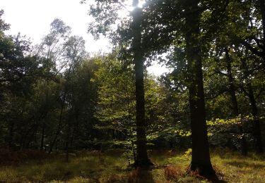
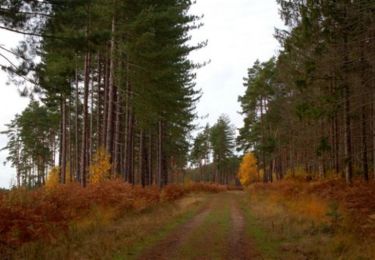
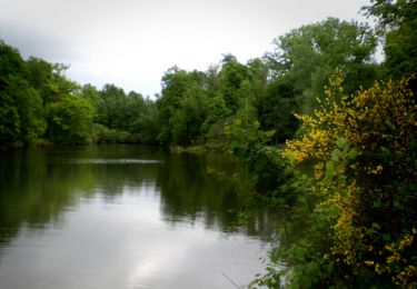
Trail Walking of 13.6 km to be discovered at Ile-de-France, Yvelines, Gambaiseuil. This trail is proposed by cire755082.

Description

Parcours facile et cueillette de champignons

Elevation profile

Positioning

Country:
France
Region :
Ile-de-France
Department/Province :
Yvelines
Municipality :
Gambaiseuil
Location:
Unknown
Start:(UTM)
406999 ; 5401123 (31U) N.

Comments

Please log in to post a review or rate the element


Trails nearby

Trail Walking Grosrouvre - _Chêne robuste et fleur de lys - Photo
Walking
GUIDE+

Walking

Easy
(4)
Grosrouvre, Ile-de-France, Yvelines, France
7 km | 8 km-effort
2h 0min
Yes
Trail Walking Saint-Léger-en-Yvelines - Saint Léger en Yvelines - Le Perray en Yvelines  - Photo
Walking
ABICHE

Walking

Easy
Saint-Léger-en-Yvelines, Ile-de-France, Yvelines, France
24 km | 28 km-effort
5h 34min
No
Trail Other activity Les Bréviaires - 1Je11 - Photo
Other activity
microb

Other activity

Very easy
Les Bréviaires, Ile-de-France, Yvelines, France
9.1 km | 10.2 km-effort
2h 18min
Yes
Trail Walking Les Bréviaires - rando du 21/05/2015 - Photo
Walking
microb

Walking

Easy
Les Bréviaires, Ile-de-France, Yvelines, France
8.3 km | 9.4 km-effort
2h 0min
Yes
Trail Walking Gambaiseuil - Grosrouvre - Photo
Walking
elcanario

Walking

Easy
Gambaiseuil, Ile-de-France, Yvelines, France
9.7 km | 11.2 km-effort
2h 56min
Yes
Trail Walking Gambaiseuil - _Entre forêt et clairières autour de Gambaiseuil - Photo
Walking
GUIDE+

Walking

Medium
Gambaiseuil, Ile-de-France, Yvelines, France
11 km | 13.7 km-effort
3h 3min
Yes
Trail Equestrian Gambaiseuil - Rambouillet escarpée - Photo
Equestrian
tracegps

Equestrian

Difficult
(1)
Gambaiseuil, Ile-de-France, Yvelines, France
5.9 km | 7.8 km-effort
49min
Yes
Trail Walking Montfort-l'Amaury - De Montfort l'Amaury à Gambaiseuil - Photo
Walking
tracegps

Walking

Difficult
Montfort-l'Amaury, Ile-de-France, Yvelines, France
23 km | 27 km-effort
4h 45min
Yes
Trail Walking Gambaiseuil - De Gambaiseuil à Saint Léger en Yvelines  - Photo
Walking
tracegps

Walking

Medium
(1)
Gambaiseuil, Ile-de-France, Yvelines, France
22 km | 25 km-effort
4h 19min
Yes


Close
My subscriptions