


Jussat_Puy_Giroux_Tour

jagarnier
User GUIDE
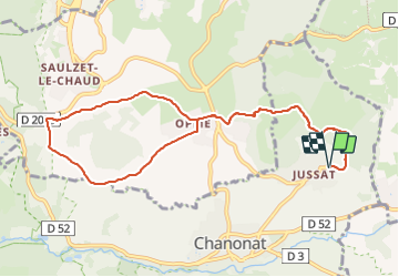

Length
10.5 km

Max alt
742 m

Uphill gradient
348 m
Km-Effort
15.1 km

Min alt
556 m

Downhill gradient
348 m
Boucle
Yes
Creation date :
2018-04-17 10:31:59.731
Updated on :
2024-01-04 16:39:14.668
3h00
Difficulty : Medium

FREE GPS app for hiking
 SityTrail
IGN / Geographical institutes
SityTrail Plus
The world is yours!
About
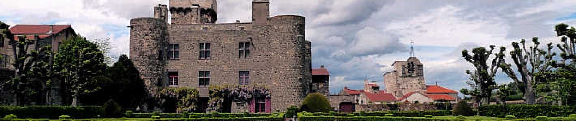
Trail Walking of 10.5 km to be discovered at Auvergne-Rhône-Alpes, Puy-de-Dôme, Chanonat. This trail is proposed by jagarnier.
Photos

Positioning
Country:
France
Region :
Auvergne-Rhône-Alpes
Department/Province :
Puy-de-Dôme
Municipality :
Chanonat
Location:
Unknown
Start:(Dec)
Start:(UTM)
508565 ; 5061001 (31T) N.
Comments