Trail Walking Pierrefonds - en forêt de Compiègne_7_Mont St-Pierre_Mont Arcy_étangs de St-Pierre - Photo

en forêt de Compiègne_7_Mont St-Pierre_Mont Arcy_étangs de St-Pierre

mes randos en forêt

© OpenStreetMap contributors
Length
Length
21 km
Max alt
Max alt
145 m
Uphill gradient
Uphill gradient
332 m
Km-Effort
Km-Effort  
25 km
Min alt
Min alt
52 m
Downhill gradient
Downhill gradient
329 m
Boucle
Boucle
Yes
Creation date :
2019-03-09 16:49:30.104
Updated on :
2020-11-08 10:27:40.731

(0 Reviews)

Walking
Walking
6h32
Difficulty : Difficult

Scan this QR Code to open this trail in the SityTrail application

FREE GPS app for hiking

Logo SityTrail SityTrail

IGN / Geographical institutes

Download SityTrail from the App Store Download SityTrail from Google Play

Logo SityTrail SityTrail World

The world is yours!

Download SityTrail from the App Store Download SityTrail from Google Play Download SityTrail on Huawei AppGallery

About

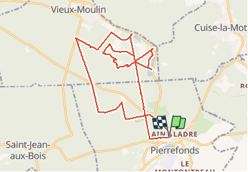
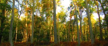
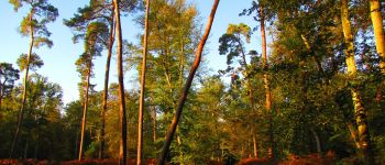
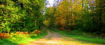
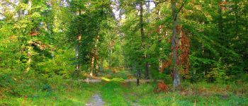
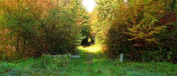
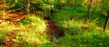
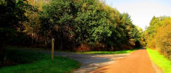
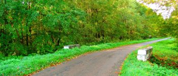
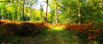
Trail Walking of 21 km to be discovered at Hauts-de-France, Oise, Pierrefonds. This trail is proposed by en forêt de Compiègne.

Description

10/ 2017
voir aussi:

http://foret-de-compiegne.over-blog.com/

batterie de recharge pour iphone indispensable.

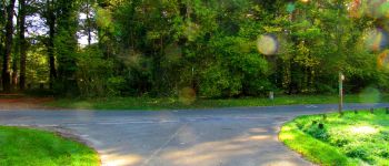
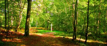
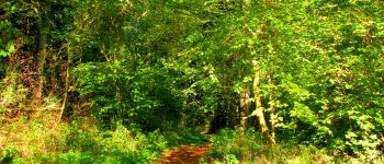
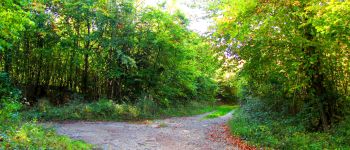
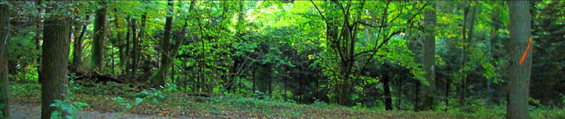
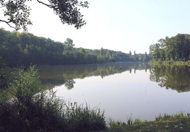
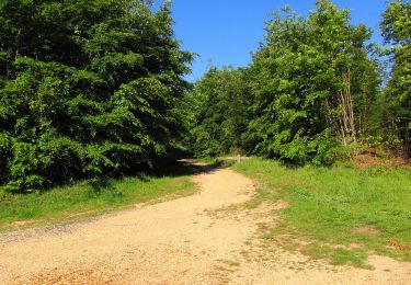
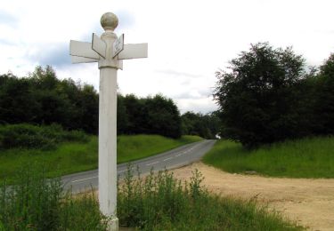
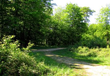
Au départ du petit parking à Pierrefonds, suivre la route de Batigny (piste cyclable) jusqu'au carrefour des étangs de Batigny. Tourner à droite dans la route du Bois de Damart et la suivre jusqu'au carrefour du Grand Veneur. Prendre à gauche la route du Mont Arcy jusqu'au carrefour Marsaux. Prendre à droite la route du vivier Payen jusqu'au carrefour du vivier Payen. Suivre la route du Fossé Coulant jusqu'au carrefour du Fossé Coulant. Prendre à droite la route de Saint-Pierre jusqu'au carrefour avec la route des étangs Varins. La suivre sur la gauche jusqu'au carrefour avec la route du Faubourg Saint-Pierre. Prendre à droite cette route jusqu'à l'étang de l'Etot. Revenir sur ses pas et prendre à gauche la route de Notre-Dame-Adam jusqu'au carrefour de Notre-Dame-Adam. Prendre à gauche la route des étangs de Saint-Pierre jusqu'au carrefour avec la D547 (les étangs de Saint-Pierre). Revenir sur ses pas et prendre à gauche le sentier qui longe l'étang. Au bout de l'étang, prendre à gauche jusqu'à la D547 (voir la maison forestière des Etangs de Saint-Pierre). Revenir sur ses pas et suivre la route de  la Gorge jusqu'au carrefour de Notre-Dame-Adam. Suivre le sentier de découverte en direction de Saint-Pierre-en-Chastres (bonne grimpette). Passer devant l'ancien Prieuré et la maison forestière du Mont-Saint-Pierre. Continuer sur le chemin de Saint-Pierre puis prendre à droite au carrefour avec la route tournante sous Saint-Pierre. La suivre jusqu'au carrefour Notre-Dame-Adam. Prendre à droite la route Notre-Dame-Adam, suivre tout droit la route des Pendants Mathieu jusqu'au carrefour avec le sentier du Diable. Prendre à gauche ce sentier jusqu'à l'arrivée (parking).

Elevation profile

Photos

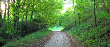
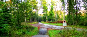
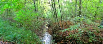
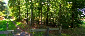
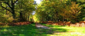
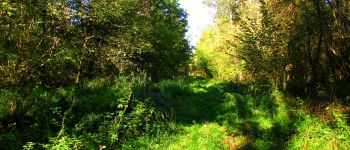
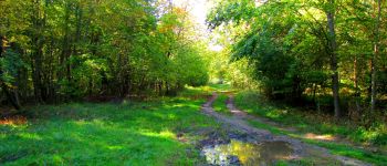
154 photos in total. Please click on a photo to see them all in the gallery.

Points of interest

Point of interest Pierrefonds - Point 1 - Photo
JeanLucA4
PIERREFONDS 
Point of interest Pierrefonds - Point 3 - Photo
JeanLucA4
PIERREFONDS 
Point of interest Pierrefonds - Point 4 - Photo
JeanLucA4
PIERREFONDS 
Point of interest Pierrefonds - Point 5 - Photo
JeanLucA4
PIERREFONDS 
Point of interest Pierrefonds - Point 6 - Photo
JeanLucA4
PIERREFONDS 
Point of interest Pierrefonds - Point 7 - Photo
JeanLucA4
PIERREFONDS 
Point of interest Pierrefonds - Point 8 - Photo
JeanLucA4
PIERREFONDS 
Point of interest Pierrefonds - Point 9 - Photo
JeanLucA4
PIERREFONDS 
Point of interest Pierrefonds - Point 10 - Photo
JeanLucA4
PIERREFONDS 
Point of interest Pierrefonds - Point 11 - Photo
JeanLucA4
PIERREFONDS 
Point of interest Pierrefonds - Point 12 - Photo
JeanLucA4
PIERREFONDS 
Point of interest Pierrefonds - Point 13 - Photo
JeanLucA4
PIERREFONDS 
Point of interest Pierrefonds - Point 14 - Photo
JeanLucA4
PIERREFONDS 
Point of interest Vieux-Moulin - Point 15 - Photo
JeanLucA4
VIEUX-MOULIN 
Point of interest Vieux-Moulin - Point 16 - Photo
JeanLucA4
VIEUX-MOULIN 
Point of interest Vieux-Moulin - Point 17 - Photo
JeanLucA4
VIEUX-MOULIN 
Point of interest Vieux-Moulin - Point 18 - Photo
JeanLucA4
VIEUX-MOULIN 
Point of interest Vieux-Moulin - Point 19 - Photo
JeanLucA4
VIEUX-MOULIN 
Point of interest Vieux-Moulin - Point 20 - Photo
JeanLucA4
VIEUX-MOULIN 
Point of interest Vieux-Moulin - Point 21 - Photo
JeanLucA4
VIEUX-MOULIN 
Point of interest Vieux-Moulin - Point 23 - Photo
JeanLucA4
VIEUX-MOULIN 
Point of interest Vieux-Moulin - Point 24 - Photo
JeanLucA4
VIEUX-MOULIN 
Point of interest Vieux-Moulin - Point 25 - Photo
JeanLucA4
VIEUX-MOULIN 
Point of interest Vieux-Moulin - Point 26 - Photo
JeanLucA4
VIEUX-MOULIN 
Point of interest Vieux-Moulin - Point 27 - Photo
JeanLucA4
VIEUX-MOULIN 
Point of interest Vieux-Moulin - Point 28 - Photo
JeanLucA4
VIEUX-MOULIN 
Point of interest Vieux-Moulin - Point 29 - Photo
JeanLucA4
VIEUX-MOULIN 
Point of interest Vieux-Moulin - Point 30 - Photo
JeanLucA4
VIEUX-MOULIN 
Point of interest Vieux-Moulin - Point 32 - Photo
JeanLucA4
VIEUX-MOULIN 
Point of interest Vieux-Moulin - Point 33 - Photo
JeanLucA4
VIEUX-MOULIN 
Point of interest Vieux-Moulin - Point 34 - Photo
JeanLucA4
VIEUX-MOULIN 
Point of interest Vieux-Moulin - Point 35 - Photo
JeanLucA4
VIEUX-MOULIN 
Point of interest Vieux-Moulin - Point 36 - Photo
JeanLucA4
VIEUX-MOULIN 
Point of interest Vieux-Moulin - Point 37 - Photo
JeanLucA4
VIEUX-MOULIN 
Point of interest Vieux-Moulin - Point40 - Photo
JeanLucA4
VIEUX-MOULIN 
Point of interest Vieux-Moulin - Point 41 - Photo
JeanLucA4
VIEUX-MOULIN 
Point of interest Vieux-Moulin - Point 42 - Photo
JeanLucA4
VIEUX-MOULIN 
Point of interest Vieux-Moulin - Point 43 - Photo
JeanLucA4
VIEUX-MOULIN 
Point of interest Vieux-Moulin - Point 44 - Photo
JeanLucA4
VIEUX-MOULIN 
Point of interest Vieux-Moulin - Point 45 - Photo
JeanLucA4
VIEUX-MOULIN 
Point of interest Vieux-Moulin - Point 46 - Photo
JeanLucA4
VIEUX-MOULIN 
Point of interest Vieux-Moulin - Point 47 - Photo
JeanLucA4
VIEUX-MOULIN 
Point of interest Vieux-Moulin - Point 50 - Photo
JeanLucA4
VIEUX-MOULIN 
Point of interest Vieux-Moulin - Point 51 - Photo
JeanLucA4
VIEUX-MOULIN 
Point of interest Vieux-Moulin - Point 52 - Photo
JeanLucA4
VIEUX-MOULIN 
Point of interest Vieux-Moulin - Point 53 - Photo
JeanLucA4
VIEUX-MOULIN 
Point of interest Pierrefonds - Point 54 - Photo
JeanLucA4
PIERREFONDS 
Point of interest Pierrefonds - Point 55 - Photo
JeanLucA4
PIERREFONDS 
Point of interest Pierrefonds - Point 56 - Photo
JeanLucA4
PIERREFONDS 
Point of interest Pierrefonds - Point 57 - Photo
JeanLucA4
PIERREFONDS 
Point of interest Pierrefonds - Point 58 - Photo
JeanLucA4
PIERREFONDS 
Point of interest Pierrefonds - Point 59 - Photo
JeanLucA4
PIERREFONDS 
Point of interest Pierrefonds - Point 60 - Photo
JeanLucA4
PIERREFONDS 
Point of interest Pierrefonds - Point 61 - Photo
JeanLucA4
PIERREFONDS 
Point of interest Pierrefonds - Point 62 - Photo
JeanLucA4
PIERREFONDS 
Point of interest Vieux-Moulin - 39 - Photo
JeanLucA4
VIEUX-MOULIN 
Point of interest Vieux-Moulin - 38 - Photo
JeanLucA4
VIEUX-MOULIN 
Point of interest Vieux-Moulin - Point 49 - Photo
JeanLucA4
VIEUX-MOULIN 
Point of interest Pierrefonds - Point 2 - Photo
JeanLucA4
PIERREFONDS 
Point of interest Pierrefonds - Départ - Photo
JeanLucA4
PIERREFONDS 
Point of interest Pierrefonds - Arrrivée - Photo
JeanLucA4
PIERREFONDS 
Point of interest Vieux-Moulin - Unnamed POI - Photo
JeanLucA4
VIEUX-MOULIN 
Point of interest Vieux-Moulin - Point 48 - Photo
JeanLucA4
VIEUX-MOULIN 

Positioning

Country:
France
Region :
Hauts-de-France
Department/Province :
Oise
Municipality :
Pierrefonds
Location:
Unknown
Start:(UTM)
498211 ; 5466536 (31U) N.

Trails nearby

Trail On foot Pierrefonds - Le Voliard - Photo
On foot
PRO

On foot

Easy
(1)
Pierrefonds, Hauts-de-France, Oise, France
5.2 km | 6.4 km-effort
1h 27min
No
Trail Walking Pierrefonds - Rando couscous ATPC ARVAL 4/2/2024 - Photo
Walking
pascha

Walking

Medium
(1)
Pierrefonds, Hauts-de-France, Oise, France
9.6 km | 11.9 km-effort
2h 42min
Yes
Trail Walking Vieux-Moulin - Rando douce Vieux moulin 14/8/2022 - Photo
Walking
pascha

Walking

Medium
(1)
Vieux-Moulin, Hauts-de-France, Oise, France
8.7 km | 10.1 km-effort
2h 14min
Yes
Trail Walking Vieux-Moulin - Gorges du Han - ATPC ARVAL - Photo
Walking
pascha

Walking

Very easy
(1)
Vieux-Moulin, Hauts-de-France, Oise, France
13.2 km | 16 km-effort
2h 42min
Yes
Trail On foot Trosly-Breuil - Le Mont-Collet - Photo
On foot
PRO

On foot

Easy
Trosly-Breuil, Hauts-de-France, Oise, France
4.9 km | 6.6 km-effort
1h 29min
Yes
Trail Walking Vieux-Moulin - Gorges du Han  - Photo
Walking
pascha

Walking

Very easy
(1)
Vieux-Moulin, Hauts-de-France, Oise, France
11.5 km | 13.8 km-effort
2h 42min
Yes
Trail Walking Pierrefonds - en forêt de Compiègne_30_la Tournante sous le Mont Saint-Mard - Photo
Walking

Walking

Very difficult
Pierrefonds, Hauts-de-France, Oise, France
17.8 km | 22 km-effort
4h 41min
Yes
Trail Walking Saint-Jean-aux-Bois - en forêt de Compiègne_29_les Tournantes sur la Héronnière et sur la Tête Saint-Jean - Photo
Walking

Walking

Medium
Saint-Jean-aux-Bois, Hauts-de-France, Oise, France
10.6 km | 12.3 km-effort
3h 3min
Yes
Trail Walking Trosly-Breuil - en forêt de Compiègne_28_les Tournantes sur le Mont Saint-Mard et sur le Mont Collet - Photo
Walking

Walking

Difficult
(1)
Trosly-Breuil, Hauts-de-France, Oise, France
13.8 km | 16.1 km-effort
3h 46min
Yes


Close
My subscriptions