


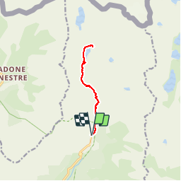
Lac de la Fous - Refuge de Nice

jlrayon
User

Length
10.3 km

Max alt
2262 m

Uphill gradient
659 m
Km-Effort
19.1 km

Min alt
1688 m

Downhill gradient
659 m
Boucle
Yes
Creation date :
2017-12-02 08:19:01.24
Updated on :
2017-12-02 08:19:01.24
3h50
Difficulty : Difficult

FREE GPS app for hiking
 SityTrail
IGN / Geographical institutes
SityTrail Plus
The world is yours!
About
Trail Walking of 10.3 km to be discovered at Provence-Alpes-Côte d'Azur, Maritime Alps, Belvédère. This trail is proposed by jlrayon.
Description
Lac de la fous et refuge de Nice par le mur des Italiens
Positioning
Country:
France
Region :
Provence-Alpes-Côte d'Azur
Department/Province :
Maritime Alps
Municipality :
Belvédère
Location:
Unknown
Start:(Dec)
Start:(UTM)
371897 ; 4881323 (32T) N.
Comments