


best tt LIMOURS 160

olivieraron
User
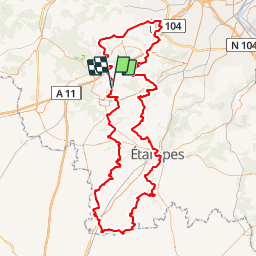

Length
160 km

Max alt
179 m

Uphill gradient
1986 m
Km-Effort
186 km

Min alt
60 m

Downhill gradient
1988 m
Boucle
Yes
Creation date :
2019-01-14 09:42:49.588
Updated on :
2019-01-14 09:42:49.708
1h33
Difficulty : Unknown

FREE GPS app for hiking
 SityTrail
IGN / Geographical institutes
SityTrail Plus
The world is yours!
About
Trail Other activity of 160 km to be discovered at Ile-de-France, Essonne, Saint-Cyr-sous-Dourdan. This trail is proposed by olivieraron.
Positioning
Country:
France
Region :
Ile-de-France
Department/Province :
Essonne
Municipality :
Saint-Cyr-sous-Dourdan
Location:
Unknown
Start:(Dec)
Start:(UTM)
428996 ; 5378141 (31U) N.
Comments