


sortie vtt du 22102017

fabwin
User GUIDE
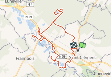

Length
24 km

Max alt
258 m

Uphill gradient
126 m
Km-Effort
26 km

Min alt
229 m

Downhill gradient
126 m
Boucle
Yes
Creation date :
2018-04-17 11:14:54.792
Updated on :
2018-04-17 11:14:54.792
1h44
Difficulty : Easy

FREE GPS app for hiking
 SityTrail
IGN / Geographical institutes
SityTrail Plus
The world is yours!
About
Trail Mountain bike of 24 km to be discovered at Grand Est, Meurthe-et-Moselle, Saint-Clément. This trail is proposed by fabwin.
Description
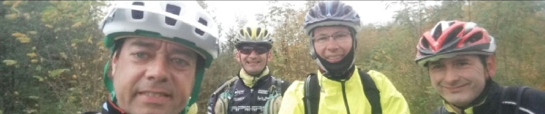
A la recherche du gué disparu!
Avec Séb, David & Jojo et ... la pluie.
Au menu, des étangs, des champs, encore des champs.
Photos


Positioning
Country:
France
Region :
Grand Est
Department/Province :
Meurthe-et-Moselle
Municipality :
Saint-Clément
Location:
Unknown
Start:(Dec)
Start:(UTM)
323011 ; 5378517 (32U) N.
Comments