


maroeuil montenescourt

Gilbert62580
User
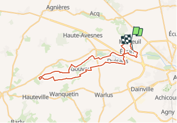

Length
29 km

Max alt
120 m

Uphill gradient
229 m
Km-Effort
32 km

Min alt
59 m

Downhill gradient
225 m
Boucle
No
Creation date :
2014-12-10 00:00:00.0
Updated on :
2014-12-10 00:00:00.0
--
Difficulty : Unknown

FREE GPS app for hiking
 SityTrail
IGN / Geographical institutes
SityTrail Plus
The world is yours!
About
Trail Mountain bike of 29 km to be discovered at Hauts-de-France, Pas-de-Calais, Marœuil. This trail is proposed by Gilbert62580.
Positioning
Country:
France
Region :
Hauts-de-France
Department/Province :
Pas-de-Calais
Municipality :
Marœuil
Location:
Unknown
Start:(Dec)
Start:(UTM)
479121 ; 5574484 (31U) N.
Comments