Trail Walking Anglefort - les sarrasins - Photo
 jibe01
jibe01

User

© OpenStreetMap contributors
Length
Length
10.8 km
Max alt
Max alt
716 m
Uphill gradient
Uphill gradient
381 m
Km-Effort
Km-Effort  
16.3 km
Min alt
Min alt
245 m
Downhill gradient
Downhill gradient
500 m
Boucle
Boucle
No
Creation date :
2018-04-17 11:36:00.818
Updated on :
2018-04-17 11:36:00.818

(0 Reviews)

Walking
Walking
3h18
Difficulty : Medium

Scan this QR Code to open this trail in the SityTrail application

FREE GPS app for hiking

Logo SityTrail SityTrail

IGN / Geographical institutes

Download SityTrail from the App Store Download SityTrail from Google Play

Logo SityTrail SityTrail World

The world is yours!

Download SityTrail from the App Store Download SityTrail from Google Play Download SityTrail on Huawei AppGallery

About

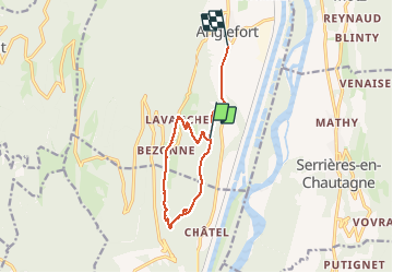
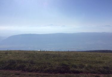
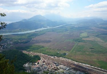
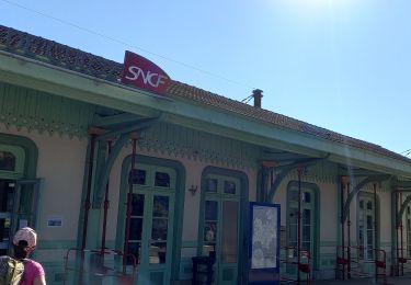
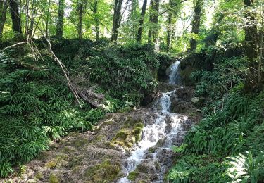
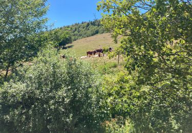
Trail Walking of 10.8 km to be discovered at Auvergne-Rhône-Alpes, Ain, Anglefort. This trail is proposed by jibe01.

Description

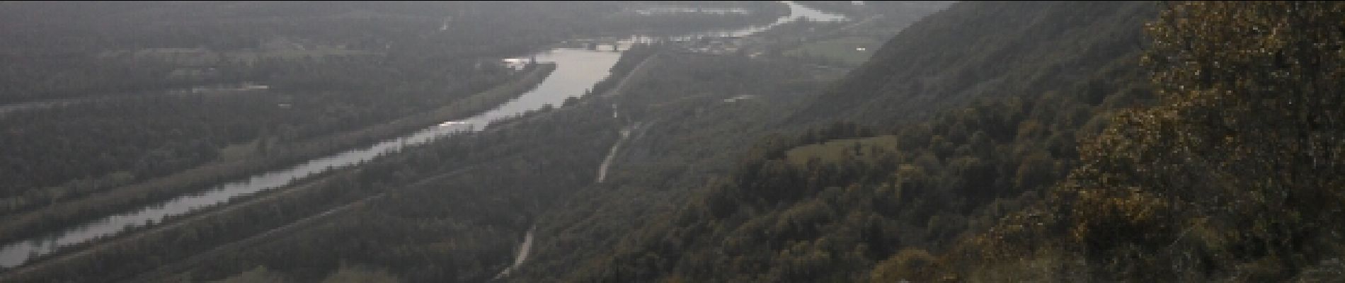
belle randonnee superbe point de vue pour pique niquer en haut du rocher

Elevation profile

Photos

Positioning

Country:
France
Region :
Auvergne-Rhône-Alpes
Department/Province :
Ain
Municipality :
Anglefort
Location:
Unknown
Start:(UTM)
717508 ; 5085448 (31T) N.

Trails nearby

Trail Walking Motz - MOTZ SERRIERES: BORDS DU RHONE - Photo
Walking
djeepee74

Walking

Difficult
Motz, Auvergne-Rhône-Alpes, Savoy, France
25 km | 30 km-effort
6h 43min
Yes
Trail Hybrid bike Culoz - ViaRhôna Culoz-Ambérieu 140km - Photo
Hybrid bike
GUIDE
thonyc

Hybrid bike

Medium
Culoz, Auvergne-Rhône-Alpes, Ain, France
140 km | 159 km-effort
14h 0min
No
Trail Walking Ruffieux - Montclergeon - Photo
Walking
Jeanjacquespenaud

Walking

(1)
Ruffieux, Auvergne-Rhône-Alpes, Savoy, France
9.3 km | 13.2 km-effort
3h 13min
Yes
Trail Walking Arvière-en-Valromey - GR 9 - Étape 13 - Chalet d’Arvières - Chanaz - Photo
Walking
pcugnod

Walking

Very difficult
Arvière-en-Valromey, Auvergne-Rhône-Alpes, Ain, France
27 km | 0 m-effort
7h 33min
No
Trail Walking Béon - Roche percée  - Photo
Walking
Arvierie56@Gmail.com

Walking

Medium
Béon, Auvergne-Rhône-Alpes, Ain, France
9.1 km | 16.5 km-effort
2h 58min
Yes
Trail Walking Serrières-en-Chautagne - Sur les Pas des Huguenots - Serrières en Chautagne - Seyssel - Photo
Walking
tracegps

Walking

Medium
Serrières-en-Chautagne, Auvergne-Rhône-Alpes, Savoy, France
10.8 km | 12.5 km-effort
3h 0min
No
Trail Walking Arvière-en-Valromey - GTJ 13 Chalet d'Arviere/Culoz - Photo
Walking
Praff

Walking

Medium
Arvière-en-Valromey, Auvergne-Rhône-Alpes, Ain, France
20 km | 29 km-effort
6h 18min
No
Trail Walking Serrières-en-Chautagne - Le sentier du Châtaigner - Photo
Walking
patjobou

Walking

Medium
Serrières-en-Chautagne, Auvergne-Rhône-Alpes, Savoy, France
7.1 km | 12 km-effort
3h 25min
Yes
Trail Walking Arvière-en-Valromey - Colombier - Photo
Walking
mrclic34

Walking

Arvière-en-Valromey, Auvergne-Rhône-Alpes, Ain, France
9.4 km | 15.2 km-effort
4h 7min
Yes


Close
My subscriptions